Mud Creek. Muskie slough and French Broad River
By Emma Castleberry
In December of 2020, Conserving Carolina purchased an 87-acre stretch of land along the French Broad River in Mills River. The following year, the nonprofit transferred the tract to the NC Wildlife Resources Commission, which has now opened the land to the public as the King’s Bridge Wildlife Conservation Area.
King’s Bridge has two thirds of a mile of frontage along the river, where the Wildlife Commission plans to provide boating access and restore the natural floodplain. Previously owned by the company Super-Sod, the land was a sod farm and a large, straight ditch cuts across fields for agricultural drainage. “The goal was to get water off the land and into the river so the land would be dry enough to farm,” explains Rose Jenkins Lane, communications and marketing director for Conserving Carolina. She adds that, while floodplains tend to have good soils, their natural tendency to flood also presents challenges for farming. “Some floodplain landowners are finding that with frequent flooding their land is not really viable as farmland, or at least it’s very challenging to farm there,” she says. “In some cases, floodplain restoration may be a better use of flood-prone land than agriculture. And these natural floodplains help reduce flooding of farmland downstream, so they benefit agriculture in that way.”
In the natural floodplain that the Wildlife Commission hopes to restore at King’s Bridge, the river will flow over and into the land rather than being separated from it. The landscape will include sloughs and wetlands that change with the water level and provide habitat for ducks, insects and salamanders. Backwater sloughs, specifically, are essential for the recovery of the French Broad River’s largest fish, the muskellunge, or muskie.
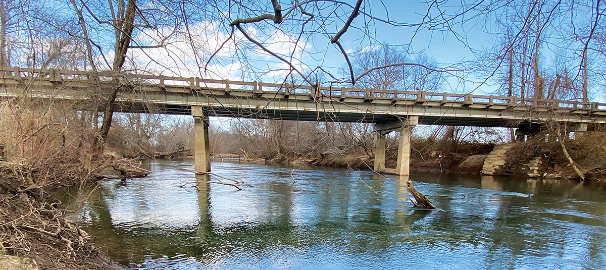
King’s Bridge on Highway 191
“Floodplains once existed along most of the French Broad River in our region, but their location and unique characteristics, such as their flat topography and fertile soil, made them prime for development and agriculture,” says David Lee, natural resources manager with Conserving Carolina. Because so many of the natural floodplains have been modified to support development, restoring spaces like King’s Bridge is even more important to the function of the river ecosystem. Floodplains not only provide critical, unique habitat for a variety of species, but they also reduce erosion and flood damage downstream and create a natural filtration process for stormwater.
Scott Loftis, an aquatic biologist with the Wildlife Commission, explains that the desired future condition of the land “is an ecologically healthy and functioning river bottom that provides wildlife habitat as well as some level of public access to the French Broad River, ideally boating access.
Portions of this property may end up as wetland and bottomland forest, which will take decades to develop.” The timeline for transforming King’s Bridge will also be influenced by the planned upgrade and widening of NC Highway 191, which serves as the western boundary of the property. For now, the property is open to the public for fishing, birding and wildlife observation.
King’s Bridge Wilderness Area is located south of Mills River on NC Highway 191 at the GPS coordinates 35.371093, -82.531256. There is a small parking area on the east side of the highway, marked with Wildlife Commission signage. For more information about King’s Bridge and the work of Conserving Carolina, visit ConservingCarolina.org.